THE WATER TAP FEE HAS ALREADY BEEN PAID! This stunning hilltop parcel near Sanchez Reservoir is in the Little Norway subdivision approximately 14 miles from San Luis, Colorado. All lots in this subdivision have on-site access to water and electricity. There’s plenty of relatively level space for building or just clearing an area for a camping pad. This area has pinon pine, juniper, and sagebrush, and home to wildlife including deer, elk, eagles, hawks, and, wild horses. This lot is in Little Norway Phase 3, which has no Property Owners Association (POA) and no POA dues. There are modest and reasonable covenants for property owners to follow. The covenants allow for short-term camping and are less restrictive than the current county rules on camping. Options for longer-term temporary habitation during construction is available. There is a boat ramp 4 miles away for recreational boating or fishing.
Basic Details
Land
For Sale
2246920
$21,000
0
0
0
0 Sqft
0
3.40 Acre
Active
Unimproved Land
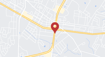
Address Map
US
CO
Costilla
San Luis
81152
Alta Mesa
0
Drive
0
W106° 34' 10.4''
N37° 4' 48.4''
Additional Information
$0
$0
$0
From San Luis Coffee Company (405 Main St, San Luis, CO 81152) Head south on Main St toward 4th St/County Rd P.6 Turn left onto 4th St/County Rd P.6 Turn right onto County Rd 21 Turn right onto County Rd L.5 County Rd L.5 turns slightly right and becomes Rd 19 Turn left onto County Rd 18.9 Continue onto Rd 18 Turn right onto Rd 18/Mesa Dr E Turn left onto Alta Mesa Dr Lot will be on the left after 1.5 miles. Please note the correct road name per county records is Alta Mesa Drive. This road is called “Buck Horn Trail” on Google Maps.
The data relating to real estate for sale on this website comes in part from the REColorado.
All information is deemed reliable but not guaranteed and should be independently verified. All properties are subject to prior sale, change, or withdrawal. Neither listing broker(s) nor Sessions Real Estate shall be responsible for any typographical errors, misinformation, misprints and shall be held totally harmless. Property locations as displayed on any map are the best approximations only and exact locations should be independently verified.